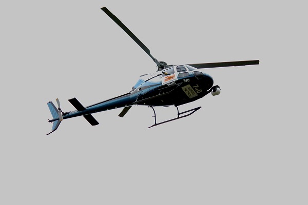

Essential Energy will soon take to the skies above Bega and surrounds, using handheld specialist high-definition equipment to undertake a further assessment on the condition of the electricity network in the aftermath of the devastating fires of late 2019 and early 2020.
High-definition imagery capture will be taken along a more direct and higher flight path than in previous years. Previously, the helicopter had to fly low and frequently over some powerlines to get the same quality.
Operations Manager South Eastern, Darren Basterfield, said “The newer technology will not only mean a faster delivery of the images but also lessen the impact on people and livestock in the flight path.”
“These flights are a crucial part of our broader program to understand the condition of the network so we can identify and repair damaged or deteriorating network assets according to the risk they present.”

The helicopter will be used to fly the powerlines in the Bega Valley Shire area.
“Our overall Bushfire Risk Management Plan involves this helicopter-led data capture, other aerial inspections, drone and ground-based asset inspections combined with our network analysis, to understand and manage risk to ensure the safety and reliability of the network,” Darren said.
Customers can learn more about aerial inspections, including how to arrange for notification prior to the flights commencing by visiting HERE.
If the inspections identify an issue with the Essential Energy network, the network will be repaired according to the risk to network reliability and community safety. Follow Essential Energy on Facebook and Twitter for updates on aerial patrols or click HERE for further information.
Weather permitting, the patrols will take place commencing in late January 2022.